Agriculture & Farming Powered byClimate Intelligence
Empowering everyone with affordable, timely, and actionable climate-smart decisions. By harnessing the power of satellite data and AI, we give you the tools to optimize crop yields and save water, no matter how remote your village is.






Introducing Our
Live Dashboard
We've launched a powerful new command center for your farm. Get regional weather insights generated through advanced processing of satellite data, accessible from anywhere.
Regional Level Forecast
Accurate weather outlooks and climate trends tailored for your broader region.
Satellite Processing
Advanced analysis of satellite imagery for precision climate tracking.
Climate Intelligence
Actionable climate intelligence and regional weather tracking.
Weather Alerts
Get instant warnings for impending severe and extreme weather.
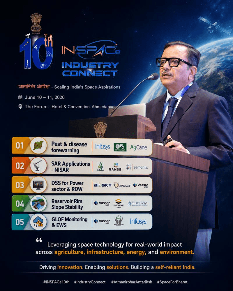
JalViks Selected for SAR Applications - NISAR by IN-SPACe
JalViks has been selected by the Indian space sector regulator and promoter, IN-SPACe, to receive financial assistance for a Proof of Concept (PoC) under its Downstream Applications program. Out of 92 proposals submitted nationwide, JalViks' project was chosen for demonstrating applications based on NISAR Synthetic Aperture Radar (SAR) data.
The project aims to develop climate-resilient agricultural and environmental intelligence solutions by leveraging advanced space technology. This milestone supports JalViks' mission of advancing climate-resilient agricultural and climate intelligence solutions through space technology. We sincerely thank IN-SPACe India, Prof. Subimal Ghosh, Prof. Raghu Murtugudde, the Lupin Human Welfare & Research Foundation, Society for Innovation & Entrepreneurship (SINE), IIT Bombay, the IDEAS team at DSSE, IIT Bombay, and the entire Team JalViks for their invaluable guidance, support, collaboration, and dedication throughout this journey.
View AnnouncementWhy Choose Us
Where Innovation meets Agriculture
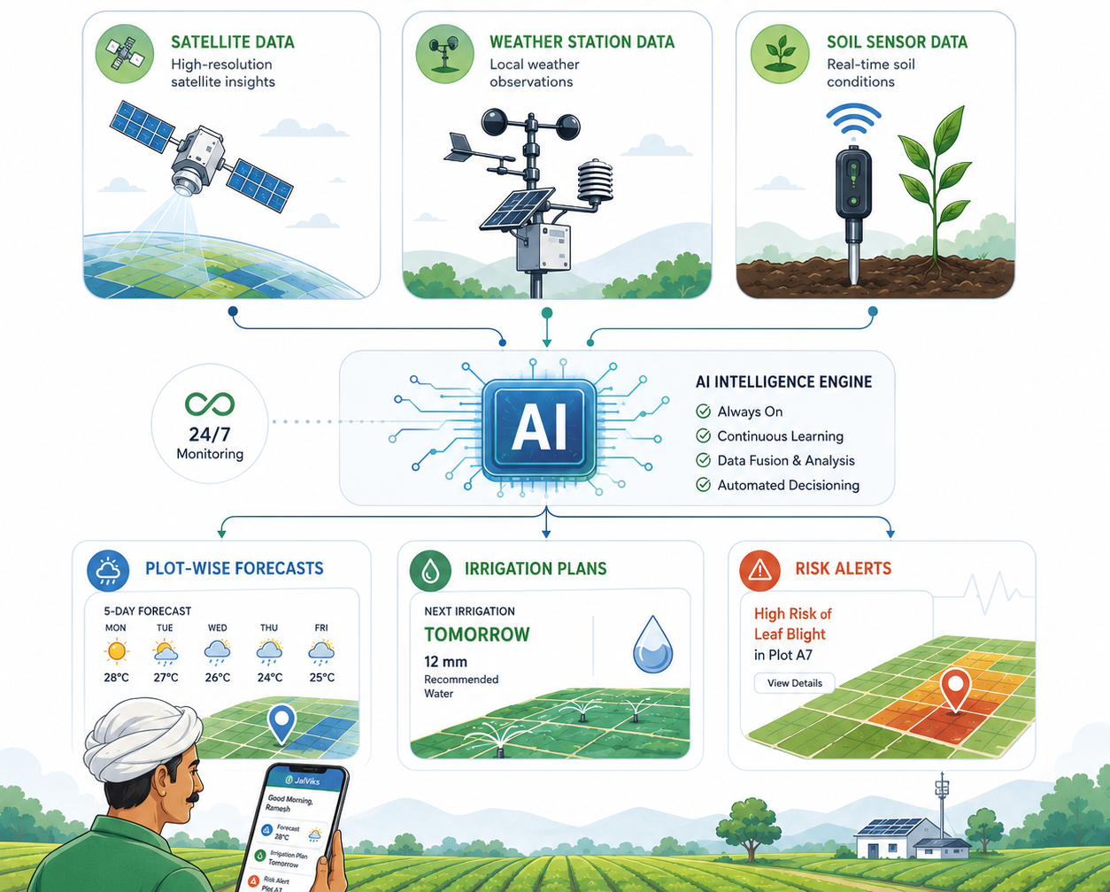
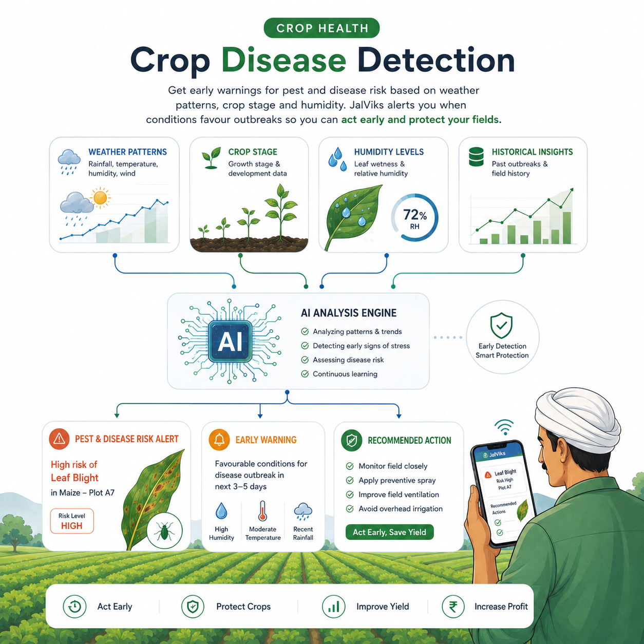
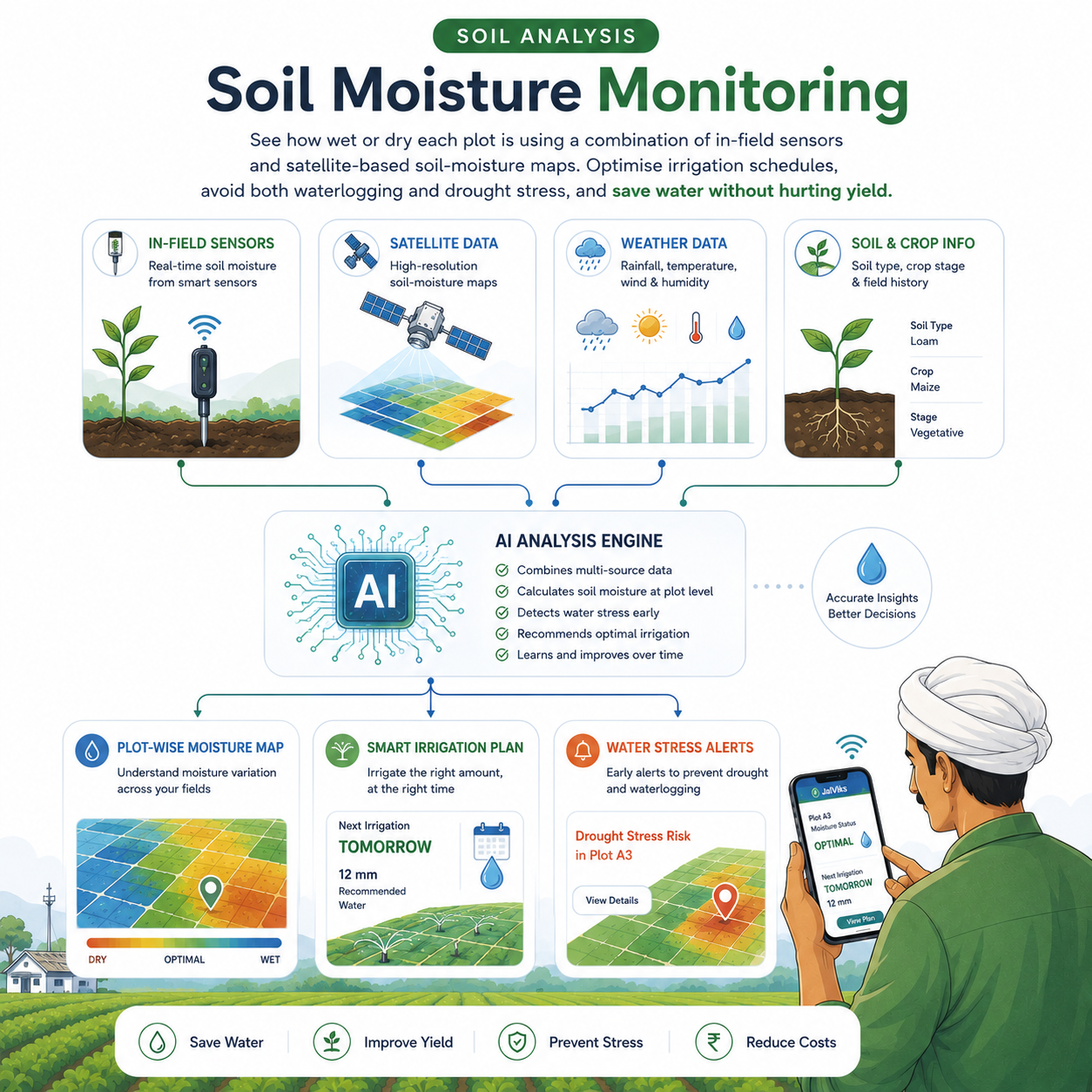
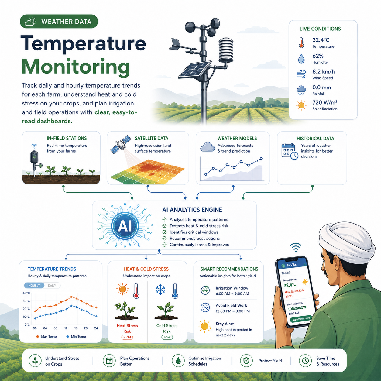
Autonomous Climate Monitoring
An always-on intelligence engine that ingests satellite, station and sensor data to generate plot-wise forecasts, irrigation plans and risk alerts— automatically, every day, without manual effort.


About JalViks
Climate Service

JalViks is a Climate Intelligence platform built to support farmers, FPOs, and agri-businesses in water-stressed regions. By combining satellite observations, weather data, and advanced AI models, JalViks delivers field-level rainfall forecasts and localized climate insights.
As the platform continues to evolve, JalViks aims to provide actionable advisories that help farmers optimize irrigation, plan sowing, and build resilience against extreme weather events. Our mission is to make agriculture more climate-smart by reducing risk, improving resilience, and making every drop of water count.

JalViks is a Climate Intelligence platform built to support farmers, FPOs, and agri-businesses in water-stressed regions. By combining satellite observations, weather data, and advanced AI models, JalViks delivers field-level rainfall forecasts and localized climate insights.
As the platform continues to evolve, JalViks aims to provide actionable advisories that help farmers optimize irrigation, plan sowing, and build resilience against extreme weather events. Our mission is to make agriculture more climate-smart by reducing risk, improving resilience, and making every drop of water count.


Benefits
All Farm Data in One App Coming Soon...
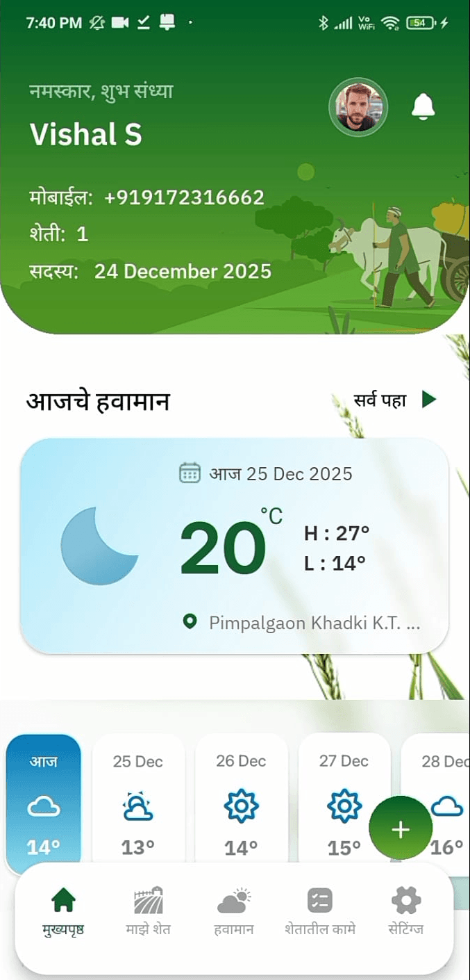
Real Time Tracking
Soil Moisture
Farm Report
Crop Staging Data
Weather
Real Time Tracking
Soil Moisture
Farm Report
Crop Staging Data
Weather
Supported By